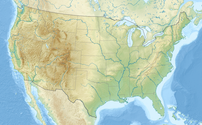
Амодуль:Location map/data/USA
| name | the United States | ||
|---|---|---|---|
| x | 50.0 + 124.03149777329222 * ((1.9694462586094064-($1 * pi / 180)) * sin(0.6010514667026994 * ($2 + 96) * pi / 180)) | ||
| y | 50.0 + 1.6155950752393982 * 124.03149777329222 * ( 0.02613325650382181 - (1.3236744353715044 - (1.9694462586094064 - ($1 * pi / 180)) * cos(0.6010514667026994 * ($2 + 96) * pi / 180))) | ||
| image | Usa edcp location map.svg
| ||

| |||
| image1 | Usa edcp relief location map.png
| ||

| |||
Амодуль:Location map/data/USA is a location map definition used to overlay markers and labels on an equidistant conic projection map of the United States. The markers are placed by latitude and longitude coordinates on the default map or a similar map image.
Usage
These definitions are used by the following templates when invoked with parameter "USA":
{{Location map | USA | ...}}{{Location map many | USA | ...}}{{Location map+ | USA | ...}}{{Location map~ | USA | ...}}
Map definition
name = the United States- Name used in the default map caption
image = Usa edcp location map.svg- The default map image, without "Image:" or "File:"
image1 = Usa edcp relief location map.png- An alternative map image, usually a relief map, which can be displayed via the relief or AlternativeMap parameters
x = 50.0 + 124.03149777329222 * ((1.9694462586094064-($1 * pi / 180)) * sin(0.6010514667026994 * ($2 + 96) * pi / 180))- An expression to calculate a location on the map via its longitude; evaluates as 0 along the left edge and 100 along the right edge
y = 50.0 + 1.6155950752393982 * 124.03149777329222 * ( 0.02613325650382181 - (1.3236744353715044 - (1.9694462586094064 - ($1 * pi / 180)) * cos(0.6010514667026994 * ($2 + 96) * pi / 180)))- An expression to calculate a location on the map via its latitude; evaluates as 0 along the top edge and 100 along the bottom edge
Alternative map
The {{Location map}}, {{Location map many}}, and {{Location map+}} templates have parameters to specify an alternative map image. The map displayed as image1 can be used with the relief or AlternativeMap parameters. Examples may be found below or in the following:
- Template:Location map#Relief parameter
- Template:Location map+/relief
- Template:Location map#AlternativeMap parameter
- Template:Location map+/AlternativeMap
Examples using location map templates
Location map, using default map (image)
{{Location map | USA
| width   = 250
| label   = Washington, D.C.
| lat_deg = 38.89
| lon_deg = -77.04
}}
Location map many, using relief map (image1)
{{Location map many | USA
| relief   = yes
| width    = 250
| caption  = Two locations in the United States
| label1   = Washington, D.C.
| lat1_deg = 38.89
| lon1_deg = -77.04
| label2   = Seattle
| lat2_deg = 47.61
| lon2_deg = -122.33
}}
Location map+, using AlternativeMap
{{Location map+ | USA
| AlternativeMap = Usa edcp relief location map.png
| caption = Two locations in the United States
| width   = 250
| places  =
  {{Location map~ | USA
  | label   = Washington, D.C.
  | lat_deg = 38.89
  | lon_deg = -77.04
  }}
  {{Location map~ | USA
  | label   = Seattle
  | lat_deg = 47.61
  | lon_deg = -122.33
  }}
}}
Location map, one location on three maps
Ошибка Lua в Амодуль:Location_map на строке 522: Unable to find the specified location map definition: "Амодуль:Location map/data/USA Tennessee" does not exist.
{{Location map | USA#USA Tennessee#North America
| relief  = yes
| width   = 250
| lat_deg = 36.167
| lon_deg = -86.783
| label   = Nashville
}}
Location map, three maps and three captions
Ошибка Lua в Амодуль:Location_map на строке 522: Unable to find the specified location map definition: "Амодуль:Location map/data/USA Tennessee" does not exist.
{{Location map | USA#USA Tennessee#North America
| relief  = yes
| width   = 250
| lat_deg = 36.167
| lon_deg = -86.783
| label   = Nashville
| caption = Location in the [[United States]]##Location in [[Tennessee]]##Location in [[North America]]
}}
See also
Location map templates
- Template:Location map, to display one mark and label using latitude and longitude
- Template:Location map many, to display up to nine marks and labels
- Template:Location map+, to display an unlimited number of marks and labels
Creating new map definitions
return {
	name = 'the United States',
	x = '50.0 + 124.03149777329222 * ((1.9694462586094064-($1 * pi / 180)) * sin(0.6010514667026994 * ($2 + 96) * pi / 180))',
	y = '50.0 + 1.6155950752393982 * 124.03149777329222 * ( 0.02613325650382181 - (1.3236744353715044 - (1.9694462586094064 - ($1 * pi / 180)) * cos(0.6010514667026994 * ($2 + 96) * pi / 180)))',
	image = 'Usa edcp location map.svg',
	image1 = 'Usa edcp relief location map.png'
}

